
Hurst Street Directory Starting Steps
Resolve the address before attaching a name to it. For a Hurst street directory search, begin in the Tarrant County GIS Public Map Viewer with Address selected. Save the parcel geometry and any account information that the map displays. Then search the same address or account in Tarrant Appraisal District Property Search. TAD provides the appraisal-side record, while the county tax system provides the billing-side record. The result is a compact parcel profile rather than a list of occupants.
- Enter the full Hurst address in GIS and compare the selected parcel with the street location. If the match looks uncertain, test the number and street name without a directional word or street type.
- Use the GIS account or the address in TAD. Keep the account number, geo reference, property address, and legal description together in your notes.
- Search the Tarrant County tax portal by Property Location or Account Number. Check the situs and owner-address labels separately.
- Move from the legal description or instrument number to Tarrant County Official Records Search. Search the grantor, grantee, subdivision, document type, or date instead of expecting a deed to be indexed by street address.
- Use a dated street guide or reverse directory only after confirming that the volume covers Hurst. A household entry may identify an occupant or subscriber, not a deed owner.
Each link answers a narrower question. GIS orients the search, TAD identifies appraisal fields, tax records describe an account, and the recorded index points to an instrument. A street-only match can select the next parcel or an older address, so compare the account, georeference, legal description, subdivision, and map shape before continuing.
Hurst Street Directory TAD Fields
TAD offers Residential, Commercial, Mineral, and Personal Property choices, an “Enter Your Search” box, and an Interactive Map route. The inspected public results show Account #, Geo Reference, Property Address, Property City, Primary Owner Name, and Market Value. Result pages also provide Export and row-count controls for 25, 50, or 100 results. No complete public coverage-year span, street-wide export format, or adjacency control was verified, so a long-street search should not be described as a complete roll.
| Hurst street directory field | Portal control or result | How to use it |
|---|---|---|
| Property type | Residential, Commercial, Mineral, Personal Property | Choose the record class before comparing results. |
| Search input | “Enter Your Search” plus Search | Start with address or a retained account/georeference. |
| Results | Account #, Geo Reference, address, city, primary owner, market value | Use account and geo reference to confirm the parcel. |
| Detail card | Current owner, owner address, legal description, site and notice fields | Preserve labels and dates; do not turn an appraisal field into an occupancy claim. |
The official TAD result screen below is the assigned interface example for this Hurst street directory.
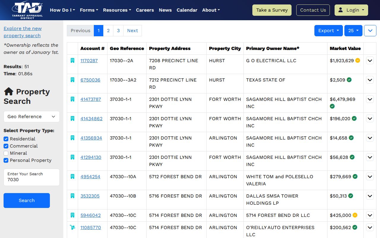
The screenshot shows why a search result needs more than an address. Its account and geo-reference columns can be compared with GIS, and its detail fields distinguish the primary owner address from the physical property address.
Note: TAD’s public interface did not expose all validation rules or a complete online coverage period, so retain the source date with every result.
Hurst Street Records in Tax Search
The tax portal is useful after a parcel has been resolved. Its Search By menu offers Account Number, Owner Address, Owner Name, and Property Location. It also shows Account Type, Include Inactive Accounts, Pay Status, a security check, and a run date. The portal advises using the actual property location for a situs search and says street type or direction may be omitted. A mailing-address search needs a number and street name.
Tax-account details observed in the official interface include owner, mailing address, real-account type, ownership percentage, location or situs, legal description, acreage, year built, square footage, UDI, annual values, exemptions, amount due, payment history, receipts, and an estimator. Values and payment status belong to a year and run date. A paid bill is not proof of ownership, and the tax portal is not the definitive deed source.
Hurst Street Directory Record Layers
No single Hurst street directory establishes every relationship to an address. The address-keyed sources below should be read as separate layers. TAD and tax records can expose current administrative fields, GIS provides parcel geometry, and recorded instruments document a filing. The individual voter lookup is not a street roster, and city-held permit or code material may require a focused request.
| Address-keyed source | Keeper | What it can show | Access route |
|---|---|---|---|
| Appraisal record | Tarrant Appraisal District | Account, geo reference, property address, owner and appraisal fields | Public TAD search |
| Tax account | Tarrant County tax portal | Situs, mailing address, account details, values, exemptions and payment history | Public search and detail |
| Parcel map | Tarrant County GIS | Address, account or owner search with parcel geometry and map links | Public viewer |
| Recorded instrument | Tarrant County Clerk, Real Estate Records | Deeds, plats, liens, powers of attorney and related filings | Public index, copy options and counter |
| City-held address file | City of Hurst | Specified permits, code matters, planning or municipal records if retained | Written Public Information Act request |
Texas My Voter Portal is an individual lookup with Name, County, Date of Birth, and ZIP Code fields. It is not a casual way to publish a street list. A broader state voter-data request has an affidavit, deposit, field-selection rules, and use restrictions. Protected addresses may appear as asterisks, which is a confidentiality measure rather than a failed match.
Hurst Street Directory GIS Check
The GIS viewer has Address, Account, and Owner search choices. Its visible side panels include Layer List, Facilities, Crime Map Portal, and Links, with routes to County resources, voter lookup, TAD, FEMA, and other services. The inspected text did not verify a dedicated neighboring-parcel button, a complete layer list, print behavior, or historical imagery. Use the viewer to orient on a parcel, then verify the relationship through TAD, tax, and the deed index.
| GIS search field or panel | Observed interface | Street-directory use |
|---|---|---|
| Address | Address radio with “Enter address...” input | Locate the physical parcel before selecting an owner or deed lead. |
| Account | Account search choice | Reconnect the map to the identifier retained from TAD or tax search. |
| Owner | Owner search choice | Use as a comparison path, not as proof of occupancy or a street roster. |
| Links and Layer List | Visible panels with TAD, voter lookup, FEMA, County, and other routes | Move to the source that answers the separate appraisal, voter, flood, or county question. |
The county’s GIS Portal Assistant is the documented alternate entry point when the principal public viewer does not load.
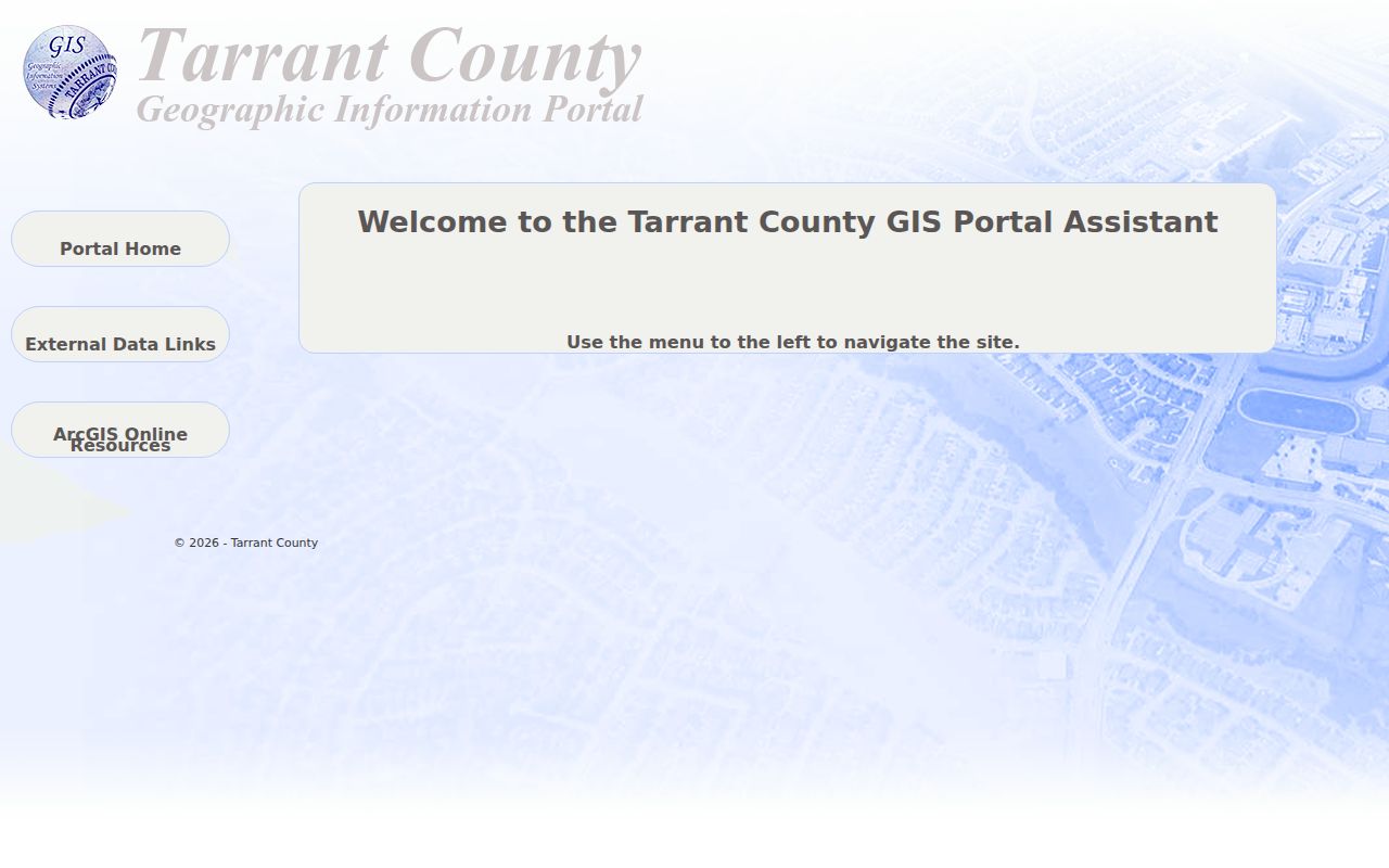
That alternate entry point supports the map-first part of a by-address workflow. It does not replace a recorded instrument, and GIS map geometry alone does not prove legal ownership.
Hurst Street Directory Address Terms
Small label differences prevent large errors in a street-by-street search. Keep the portal’s wording when you copy a field, especially when an address has changed, a parcel was split, or a development uses several street numbers.
- Parcel
- A mapped unit of real property used by appraisal and tax systems. It may be joined, split, or assigned more than one street number.
- Situs address
- The physical property location shown in an appraisal or tax record. It is not necessarily the owner’s mailing address.
- Legal description
- The subdivision, block and lot, tract, or metes-and-bounds wording that helps keep a property identifiable when street labels change.
- Plat
- A recorded map that can explain a subdivision, lot label, road name, dedication, or earlier layout.
- Criss-cross directory
- An address-oriented directory section. It can be an historical lead only after the volume’s Hurst coverage and date are checked.
For a scan-confirmed historical street guide, use the repository routes and coverage cautions collected with the Hurst city directory collections. Regional titles may include Hurst, omit it, or use a larger telephone exchange, so the volume’s own title and coverage statement control.
Hurst Street Directory Deed Trail
A deed search begins with the parcel identifiers, not a promise that every instrument will index by address. Tarrant County Official Records Search supports grantor or grantee, subdivision, document type, document number, and date research. County real-estate records include deeds, plats, liens, powers of attorney, oil and gas records, and related instruments. Record execution date, recording date, and document date separately because they can differ.
The Tarrant County Clerk does not perform title or lien searches. Follow the index chain yourself for research, or consult a qualified professional when a legal title conclusion is needed. The county offers in-person Room B30 and kiosk access, free unofficial watermarked online copies with account/download, online certified orders through an account and order history, and mail requests with a document number, payment, and a self-addressed stamped envelope. The copy page lists $1 per page plus $5 for certification.
The official County real-property copy instructions shown below document those copy routes.
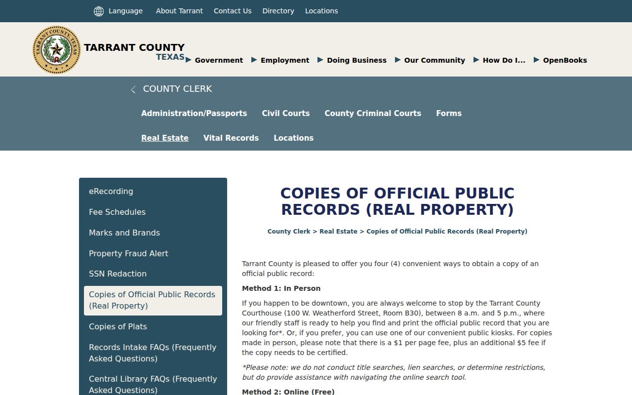
The image reinforces the difference between an index lead and a copy request. An unofficial download helps research, while certification is a separate county service. No official current page in the research stated a complete online deed-image cutoff.
Hurst Street Directory City Requests
For a permit, code-compliance disposition, planning file, municipal docket, or other city-held address record with no public index, submit a specific written request through the Hurst City Secretary’s Public Information Act form. The online form captures contact details plus the date, name, and description of requested records. The city asks for a written, specific request; a date range and one record category make retrieval more practical.
Hurst Citizen Self-Service supports current permits, plans, inspections, invoices, and transactions, but the research did not verify a public historical permit index, anonymous record-search behavior, or a retention period. Request a named address, date range, and category rather than asking the city to create a list or supply a legal conclusion. The Texas Public Information Act is Government Code Chapter 552.
Hurst Street Directory ZIP Checks
Hurst addresses use 76053 and 76054 as verified postal starting points, but a ZIP label cannot settle a parcel’s municipal jurisdiction. USPS validates a delivery point. GIS helps test municipal placement, TAD identifies appraisal geography, and the tax portal separates property location from owner address. Use the exact postal city label returned by each source and maintain a separate jurisdiction field when the distinction matters.
Older deeds and directories may show no ZIP, an old postal city, a rural route, or a tract description. In that setting, search the street, county, subdivision, community name, landmark, and legal description together. Research did not establish a historical 76053 or 76054 boundary chronology, a complete list of postal aliases, or a Hurst street-renumbering record, so do not fill such a gap with a modern ZIP.
Note: An address match requires both a delivery check and a parcel check, because postal, appraisal, tax, and municipal fields describe different systems.
Hurst Street Directory Privacy Limits
A street record may identify a parcel, an appraisal owner field, a mailing address, or parties to a recorded instrument. It does not reliably identify every person at an address. Renters and other household members are not consistently indexed in the public parcel roll. DMV addresses are restricted, utility-customer information was not located as a public Hurst lookup, association membership is not established by a management certificate, and protected voter addresses can be suppressed.
Deeds, appraisal records, tax accounts, directories, and oral history also use different relationship labels. A deed names parties to an instrument, a tax or TAD field reflects administration, and an older directory can list a householder or subscriber. Preserve the source date and role. If records conflict, retain both values with their sources rather than selecting the most convenient name.